 by
by Lhe IGN maps half-folded on the dashboard have long been replaced by navigators nestled in the palm of our hand. Could Google Maps, Waze and other Plans in turn be replaced by an application produced by the National Institute of Geographic and Forestry Information (IGN)? Nothing is less certain, but the application has other advantages so that its map gives us another vision of the territory.
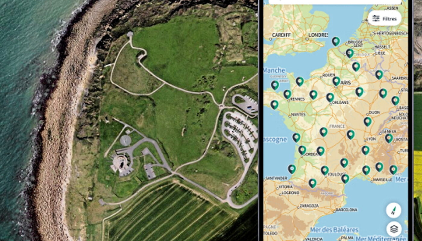
IGN Maps, published by the public institute on May 15, is in reality a new name and a huge update of the Géoportail application. Users of the IGN historical tool saw the change on Monday. The new version brings features that we all know. Maps or aerial photos, route calculation, search for businesses, points of interest and opening hours are all available.
On these points, the comparison is not always flattering: the route is only available on foot or by car and does not adapt to traffic, the timetables are available half the time depending on the location, and the pick-up points interest, such as bus stops, public toilets, historic buildings or businesses, are found pell-mell on the map.
A non-commercial card
This impression of confusion is not a bug, it is the very principle of the application. “Gafam maps have a commercial representation of the world, with the promotion of certain premises more than others,” explains Laurent Toustou, of IGN. “We offer the visualization of more neutral data, validated by our services and enriched by information from OpenStreetMap when available. »
The “neutral” information is that provided by the IGN topographical data. Height of buildings, dates of construction, forest species, cultivation of agricultural plots are all information that IGN has and which it makes accessible with a simple click on the new application. “Gafam gives us a very urban vision of the world,” continues Sébastien Soriano, the general director of the institute.
“I always find it sad to see that these services make 90% of the territory invisible. We show its completeness. Not just roads and big brands, but also forests, fields, natural areas… Our conviction is that reading the territory is already changing it. In the age of the Anthropocene, this seems important to us. »
Compare the present to the past
If urban route calculation undoubtedly remains the prerogative of Google and Apple, observation of the territory gives the advantage to IGN Maps. Among the base maps available, we note the Topo 25, or Scan 25, dear to hikers for its precision of paths and elevations. The institute also makes available its library of aerial images dating back to the 1950s to examine the retreat of the coastline, the transformation of the bocage into large agricultural plots or simply the galloping urbanization from the Trente Glorieuses to the present day.
“Where they are strong is in updating information,” judges Philippe Cocheril, head of the geographic information system at Rennes Métropole. “Local authorities update the maps as soon as a street is modified, or a subdivision is built, for example. » This information then enriches the State’s nine reference data sets, the same ones used by the IGN application.
Contributing to the “geocommons”
However, should we store paper maps in the attic? If you’re not a fan of total disconnection, yes. The publication of this application is also the symptom of a transformation of the IGN. It has published its data for free, under an open license, since January 2021. The end of a French particularity illustrated by Christophe Claramunt, research director at the Brest Naval School: “American scientists often said that we had to pay geographic information twice: first with the taxes that finance the IGN, then when we buy it from the IGN. »
The change which coincides with the arrival of Sébastien Soriano at the head of the public institute leads towards a broader horizon, called the geocommons. The goal: that each production of geographic information can be used by as many stakeholders as possible. This collaborative aspect is also found in IGN Maps. Among the options after selecting a coordinate, a building or a point of interest, the one called “report” allows you to indicate an inconsistency between the map and reality or to improve the precision of the information.
IGN agents receive the message, but not only. It is planned that this voluntary enrichment will also be sent to OpenStreetMap, a sort of cartographic Wikipedia, in order to power this free tool. Paradoxically, these geocommons can also be used by Google Maps, Plans and others to improve their services. Proof, if any were needed, that Cartes IGN is not exactly running in the same corridor.